


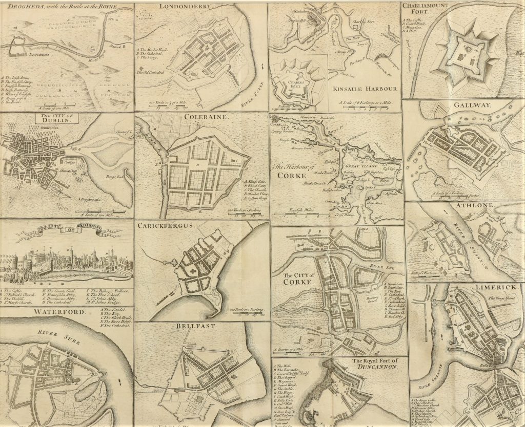
This 18th century engraved Irish Map containing Plans of Drogheda, Derry, Kinsale Harbour, Charlemont Fort, City of Dublin, Coleraine, The Harbour of Cork, Galway, The City of Kilkenny, Carrickfergus, The City of Cork, Athlone, Waterford, Belfast, The Royal Fort of Duncannon and
Limerick comes up as Lot 321 at Fonsie Mealy’s sale of contents from Killoughter House, Ashford, Co. Wicklow online on May 18. It is estimated at €200-€300. UPDATE: THIS MADE 360 AT HAMMER