Cambridge University Library is marking the 400th anniversary of John Speed’s Theatre of the Empire of Great Britaine. Each of the proof maps is now available online at www.lib.cam.ac.uk/deptserv/maps/speed.html
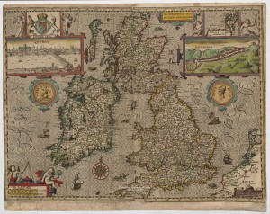
The production of this atlas in 1611 was the first time that plans of counties and towns became available in print. A major innovation it was an immediate success. It was the first time that at least 50 of the 73 towns included were mapped.
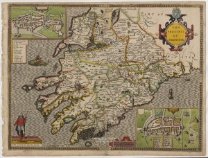
There is a single sheet for for each county of England and Wales, a map of Scotland and each of the four Irish provinces. The map of ‘Mounster’ (Munster) identifies ‘Lymerick’ and Cork as the two biggest cities. The extensive coastline is emphasised by ships and green fish-like creatures emerging from the sea.
Cambridge University Library is selling single copies of the 60 plus images that make up Speed’s masterpiece. Anne Taylor, Head of the Map Department at the University Library, said: “Although the Library holds several copies of the published atlas – including a first edition – it is the hand-coloured set of proofs produced between 1603 and 1611 that is one of its greatest treasures.”
Cambridge acquired the proofs in 1968 after the British government refused an export licence. By 1627 the atlas cost 40 shillings.
Born in Farndon, Cheshire in 1551 or 1552, John Speed was an historian as well as a cartographer. He paid tribute to earlier map-makers whose work he drew on, especially the county maps of Elizabethan surveyor Christopher Saxton. Speed wrote: “I have put my sickle into other mens corne”.


